KNKT Comprehensive Investigation: KA 4B Argo Bromo Anggrek vs KRL Collision at East Bekasi & Systemic Failure Analysis
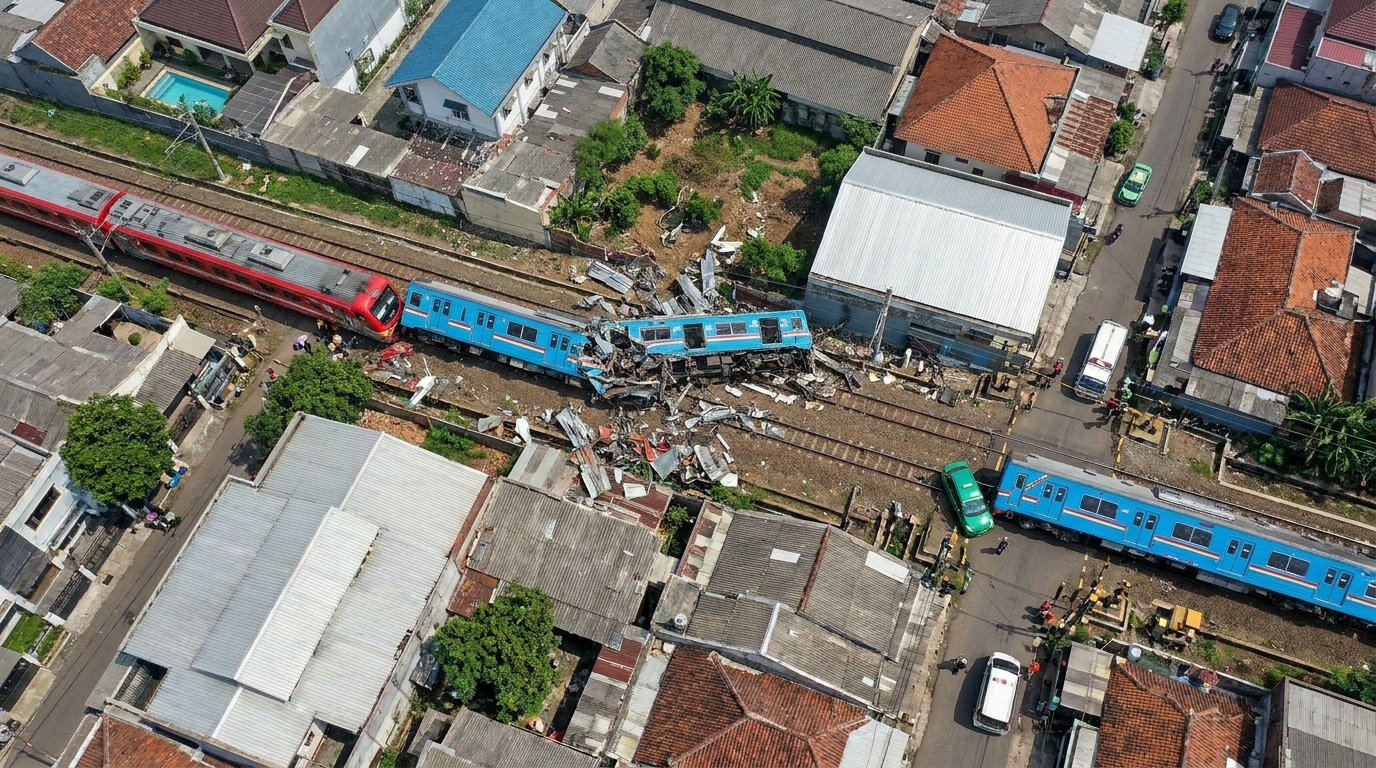
An in-depth investigation by the Komite Nasional Keselamatan Transportasi (KNKT) into the catastrophic collision between KA 4B Argo Bromo Anggrek and KA 5568A Commuter Line at Stasiun Bekasi Timur reveals that the accident was not caused by an isolated operational error, but rather by an accumulation of systemic failures. The breakdown of fail-safe safety principles within the block section signalling interlocking logic, emergency communication transmission bottlenecks in the control room, optical degradation of the locomotive cab's polycarbonate windshield, and the absence of tactical emergency braking regulations along high-speed curved alignments compounded each other, eliminating any margin for collision mitigation.
Executive Summary and Factual Incident Data
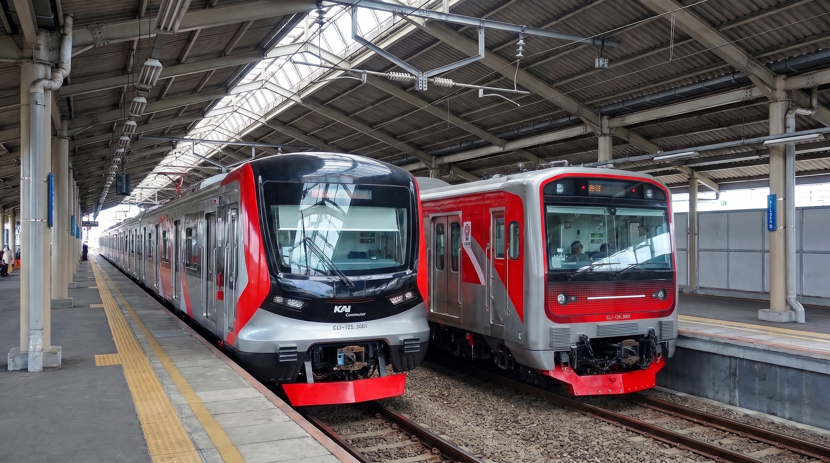
The train collision that occurred on Monday, 27 April 2026 at 20.52.12 WIB on Track I (up line) of Stasiun Bekasi Timur, Km 28+915, within the Stasiun Bekasi–Stasiun Cikarang block section, Daerah Operasi 1 Jakarta (Daop 1 Jakarta), was a catastrophic railway accident involving an executive-class intercity train and an urban commuter train. The accident involved KA 4B Argo Bromo Anggrek on the Gambir–Surabaya Pasarturi route, hauled by diesel-electric locomotive series CC 206 13 86 with a consist of 11 executive passenger cars, and KA 5568A Commuter Line on the Kampung Bandan–Cikarang route, comprising a 10-car Electric Multiple Unit (KRL) consist.
The collision occurred while KA 5568A was making an unscheduled stop at the platform of Stasiun Bekasi Timur due to an obstruction caused by crowds of residents spilling onto the up line. The KA 4B trainset, running at high speed from the west, slammed into the rear of KA 5568A. The Komite Nasional Keselamatan Transportasi (KNKT) investigation report No. KNKT.26.04.03.02 confirmed that this tragedy was not triggered by a single operational error (single point of failure), but rather by an accumulation of systemic failures. These failures stemmed from design flaws in the route interlocking logic, the degradation of the emergency communication system in the centralized control center, driver optical visibility limitations caused by aged cab window materials, and the absence of tactical guidelines governing emergency braking on high-speed track curves. The accident resulted in casualties, structural damage to rolling stock and track infrastructure, and the paralysis of rail operations across the main trunk line of western Java.
Sequence of Events
The accident at Stasiun Bekasi Timur was triggered by an antecedent incident that initiated a cascading chain reaction (domino effect) across the shared corridor. Time synchronization throughout the investigation was established by KNKT by utilizing the verified network time (Network Time Protocol / NTP UTC+7) from the electric taxi's On Board Unit (OBU) recorder and the CCTV cameras of KA 5568A as the master time reference to reconcile time offsets across all telemetry instruments and voice recorders.
The initial chain of events began at 20.48.24 WIB, when KA 5181B Commuter Line on the Cikarang–Angke route, running on the down line, struck a battery electric passenger vehicle (taxi) with license plate B 2864 SBX at level crossing JPL 86 Jl. Ampera (Km 29+400). The taxi was dragged and wedged underneath the leading cab of KA 5181B, causing the train to come to a halt and tripping the overhead catenary power supply (LAA). The violent impact at JPL 86 drew nearby residents out in droves toward the scene, gradually spilling over and occupying the adjacent up track directly alongside it.
At 20.48.55 WIB, KA 5568A arrived at Track I of Stasiun Bekasi Timur for scheduled passenger boarding and alighting. Upon completing platform duties, KA 5568A departed at 20.49.19 WIB. However, after advancing approximately 1.69 meters, the driver spotted crowds of people swarming the up line toward Tambun following the collision at JPL 86, prompting the driver to immediately execute a stop at 20.49.24 WIB to prevent striking pedestrians. With KA 5568A halted at the platform, track circuit section 104BT remained occupied.
Meanwhile, KA 4B, running under operational schedule adjustments, passed through Track III of Stasiun Bekasi without stopping at 20.50.43 WIB, encountering Exit Signal J12 displaying a green aspect. The driver of KA 4B accelerated toward the track speed limit of 114 km/h under the expectation that the block section ahead was clear and unobstructed. The driver of KA 4B only sighted a signal displaying red ahead after negotiating the track curvature and promptly initiated stepped service braking leading into emergency braking. However, the deficit in available stopping distance rendered the collision unavoidable at 20.52.12 WIB.
Technical Evaluation of Signalling Systems on the Stasiun Bekasi–Stasiun Bekasi Timur Block Section
The technical investigation of the signalling system revealed fundamental flaws in the design of the route interlocking logic following modern railway facility upgrades. Stasiun Bekasi Timur holds the status of an intermediate block station governed by an Automatic Blocking System (ABS). Track I of Stasiun Bekasi Timur is situated between Block Signal B104 (Km 28+440) and Block Signal B103 (Km 29+195). To accommodate advance train arrival warnings for the semi-automatic level crossing JPL 85 at Jl. Moh. Yamin (Km 28+725), this block section is split into two track circuits: section 104AT and section 104BT. The entire passenger platform span of Stasiun Bekasi Timur lies within track circuit section 104BT.
The evolution of the signalling design demonstrates a progressive degradation of fail-safe safety principles. Under the 2014 Design Document (Signal Aspect Drawing Step-1 Railway Electrification and Double-Double Tracking Package B1), the signalling configuration was governed by a signal-to-track dependency philosophy. In that initial design, the provision of Block Signal B105 between the Bekasi Exit Signal and Block Signal B104 guaranteed that if either section 104AT or section 104BT were occupied by rolling stock, Exit Signal J32 would display green, Block Signal B105 would display yellow, and Block Signal B104 would display red. Through this sequence, the three-aspect signalling principle was maintained in proper progression.
However, the implementation of Switch Over Phase II at Stasiun Bekasi on 20 November 2021 decommissioned Block Signal B105 and Co-acting Signal UB105 to accommodate station yard expansion, leaving the up line section with only Co-acting Signal UB104 (Km 28+030) and Block Signal B104 (Km 28+440) following the station exit signal. The 2022 Design Review Document (Signal Aspect Plan DL-23) reformulated the new signalling sequence under a signal-to-signal paradigm without mapping the granular impact of track circuit occupancy states. Consequently, the route locking logic for J12–14T at Stasiun Bekasi only verified the occupancy state of track circuit section 104AT while completely disregarding the occupancy state of section 104BT.
Signalling simulation tests conducted by KNKT on 28–29 April 2026 empirically demonstrated that whenever section 104BT was occupied by rolling stock (as when KA 5568A was held at the platform), route setting from Track III of Stasiun Bekasi resulted in Exit Signal J12 continuing to show a green aspect. At the same time, the interlocking control display (Visual Display Unit / VDU) at the Stasiun Bekasi PPKA control desk was not equipped with monitoring indicators for block signal or co-acting signal aspects on open track sections, leaving the PPKA operator without any means of visual confirmation for such anomalies. Further sample testing conducted on 12–13 May 2026 at Stasiun Manggarai uncovered an identical logic defect on the Manggarai–Sudirman route (Signals JL22A, JL42A, and JL152A remained green while section 206BT was occupied and signal B206 was red), indicating systemic methodological deficiencies in factory and site acceptance testing for electronic interlocking systems across the national railway network.
Train KA 4B Locomotive Data Logger Analysis and Braking Dynamics
Locomotive CC 206 13 86 is equipped with an integrated GE-C20EMP Electronic Brake Valve (EBV) braking system, comprising an Automatic Brake Handle (controlling brake pipe air pressure throughout the trainset) and an Independent Brake Handle (controlling the locomotive brake cylinder braking independently). Telemetry analysis from the locomotive data logger reconstructed the braking control responses executed by the driver:
The driver's action of exhausting the locomotive brake cylinder pressure (bail-off) down to 0 psi during full service braking was a train-handling technique intended to attenuate the differential deceleration rate between the locomotive and the passenger coaches behind it. The driver sought to minimize inter-car compressive coupler buff forces that could trigger severe in-train jerks.
When the driver of train KA 4B detected the red aspect on Block Signal B104 at an effective sighting distance of ±410 meters, the train was traversing horizontal curved track number IP.MC22D (curve radius R = 946 meters, situated between Km 27+398 and Km 27+685). The driver consciously chose not to initiate an immediate emergency brake application. Under the driver's technical understanding acquired through years of operating service, applying emergency braking at speeds exceeding 100 km/h while the train is negotiating curved geometry poses severe risks of train jackknifing derailment or vehicle overturn resulting from the unmanaged discharge of longitudinal inertial forces pushing against the outer rail.
The driver decided to apply full service braking first and delay emergency brake application until the locomotive had cleared the curved track approaching grade crossing JPL 85. However, the investigation revealed that the driver had never received formal simulator-based training regarding emergency braking scenarios on curved track. Service Regulation (Peraturan Dinas) Number 16A of 2023 Article 40 contains only qualitative mandates devoid of operational technical criteria, leaving emergency braking decisions entirely reliant upon the driver's subjective judgment amidst a critical emergency.
Locomotive deceleration evaluation based on data logger records is derived through the kinematic equations of uniformly accelerated rectilinear motion:
afs = (vt - v0) / Δt = (21.94 - 29.2) / 21 = -0.35 m/s²
2) Emergency Brake Phase (Δt = 16 s, v0 = 78 km/h = 21.7 m/s, vt = 40 km/h = 11.11 m/s, seb = 275 m):
aeb = (vt - v0) / Δt = (11.11 - 21.7) / 16 = -0.66 m/s²
3) Combined Average Deceleration:
aavg = (afs + aeb) / 2 = (-0.35 - 0.66) / 2 = -0.505 m/s²
4) Theoretical Stopping Distance Requirement from v0 = 105 km/h (29.2 m/s):
s = (v0²) / (2 × |aavg|) = (29.2)² / (2 × 0.505) = 844.19 m ≈ 845 meters
Because the physical distance available from the full service braking initiation point (Km 28+078) to the point of collision (Km 28+915) was only 816 meters, a stopping distance deficit of approximately 29 meters caused the impact to occur at a residual speed of 40 km/h.
Driver Cab Visibility Factors and Sensory Ergonomics
Limitations in the driver's visual detection of track conditions were influenced by an interplay between rolling stock physical materials and ambient light pollution. Based on PT KAI Rolling Stock Management Director Official Note Number 001/KR.203/R/XII/2015, the entire CC 206 locomotive fleet utilizes cab windshields made of specialized thickness polycarbonate to protect drivers from trackside projectile throwing hazards. However, polycarbonate material possesses significantly lower surface abrasion resistance compared to conventional laminated safety glass.
Physical examination of the locomotive hauling train KA 4B revealed deep wiper sweep scratches and swirl marks on the cab windshield exterior surface. At night, these micro-scratches refract external light into extensive diffuse glare (light scattering). A comparative observation conducted by the KNKT on 16 May 2026 demonstrated that visibility from the cab of a Series TM6000 EMU equipped with laminated safety glass yielded sharp, dispersion-free signal light contrast. Conversely, from the CC 206 locomotive cab, trackside light sources distorted into diffuse glare that obscured the driver's visual edge acuity.
Repeater Signal UB104 was installed at Km 28+030 utilizing a configuration of five white LED lamps to repeat the aspect of Block Signal B104 at Km 28+440, which was obscured by track curve geometry IP.MC22D, given that the direct line-of-sight sighting distance of Signal B104 was only 410 meters (failing to meet the minimum 600-meter sighting distance mandated by Minister of Transportation Regulation Number 44 of 2018). However, Repeater Signal UB104 was not equipped with a black background shield. At night, the white LED luminous emissions from this signal exhibited intensity and wavelength characteristics virtually identical to street and house lighting in the densely populated settlement along the right side of the up track (jalur hulu).
This degraded optical environment interacted with the train crew's cognitive workload and confirmation bias. Because the driver of train KA 4B had passed Exit Signal J12 at Bekasi Station displaying a green aspect, the driver's mental model was established upon the certainty that the block section ahead was clear and the subsequent signal would display at least a caution (yellow) aspect. With no scheduled intermediate stops until Cirebon Station, the driver's visual focus was directed toward high-speed cruising and did not anticipate a hazard indication from Repeater Signal UB104, which was masked amidst light pollution. The driver only realized the presence of a track obstruction hazard when the illuminated red aspect of Block Signal B104 came into direct line of sight immediately upon exiting the curve.
Operational Communication Constraints and Control Center Ergonomics
Emergency response coordination at the Daop 1 Jakarta Train Operation Control Center (Pusdal Manggarai) experienced severe bottlenecks resulting from telecommunication facility fragmentation and excessive operator workload. Operational control over physical train movements across the Eastern Region (Manggarai–Cikarang–Cikampek corridor) fell under the jurisdiction of the Eastern Train Dispatcher (PPKP Timur) desk. However, digital communication radio consoles serving KRL Commuter Line drivers (Tait Section 27 and Sepura Section 27 consoles) were physically positioned at the Southern Train Dispatcher (PPKP Selatan) desk. The PPKP Timur desk was equipped solely with a conventional analog radio console to communicate with long-distance passenger train locomotives (Section 1). This physical separation severed direct information flow between PPKP Timur and the commuter fleet operating within its territorial control.
The handling of the accident at grade crossing JPL 86 revealed a cascade of communication failures that critically delayed emergency response:
- Following the collision between train KA 5181B and an electric taxi at JPL 86, the driver of KA 5181B attempted to unclip the Tait radio microphone from its mounting bracket. This attempt failed because the microphone clip jammed, forcing the driver to transmit while hunched over in a standing posture with a mouth-to-microphone distance exceeding 5 centimeters. This exceeded the manufacturer's technical guidelines (Tait Operational Instruction TM9000), which stipulate a maximum speaking distance of ≤ 5 cm. Consequently, the transmitted audio signal suffered from poor modulation, sounding faint, reverberant, and distorted (warbling), severely impeding PPKP Selatan's ability to comprehend the message.
- The report from the driver of KA 5181B lacked standardized structure and failed to adhere to standard railway safety phraseology. The driver repeatedly uttered colloquial phrases: "hit a car, Sir" ("nemper mobil Pak"), "the car is trapped, Sir" ("mobilnya nyangkut Pak"), without promptly specifying the train number identity, kilometrage position, or structure gauge clearance status on the adjacent up track. This ambiguity forced PPKP Selatan to conduct protracted verification inquiries consuming 3 minutes and 20 seconds (20:48:44 to 20:52:04 WIB) merely to ascertain the train's location and track fouling status.
- PPKP Timur, overhearing fragmented reports from the adjacent PPKP Selatan desk, immediately contacted KA 4B via analog radio. However, the instruction given to the driver relied on ambiguous, informal terminology: "Bang, be careful around East Bekasi JPL... try braking a bit, tap the brakes lightly, bang..." ("Bang hati-hati di JPL Bekasi Timur... coba direm-rem dulu direm-rem dikit ya bang..."). The phrase "brake a bit lightly" possesses no operational definition in railway regulations and completely failed to convey the acute severity of a track obstruction, leading the driver of KA 4B to respond with only a moderate minimum service brake application.
- The driver of KA 5568A, held at the platform of Bekasi Timur Station by civilian crowds surging onto the track, attempted to contact PPKP Selatan twice, at 20:49:37 and 20:50:28 WIB via the Sepura Section 27 console. Both calls went unanswered because PPKP Selatan had physically stepped away from the workstation to the operations manager (OPKA) desk to deliver a manual verbal report of the KA 5181B accident in accordance with SOP Board of Directors Regulation Number PER.U/KT.204/VI/1/KA-2024. Because the driver of KA 5568A initiated routine individual calls rather than pressing the Emergency Call Button, the incoming calls failed to trigger an emergency barge-in override alarm on the dispatcher console.
- The Daop 1 Jakarta Operation Control Center utilized open external speakers to broadcast incoming radio calls without providing individual headsets for dispatchers. Simultaneous audio transmissions from multiple active radio sections created severe acoustic clutter (noise pollution) and perceptual confusion among dispatching staff. This environment was further compounded by the graphic display on the PPKP Timur monitor, which failed to arrange the corridor track diagram in geographic continuity and omitted the station name label "Bekasi Timur Station," displaying only an unbroken chain of track circuit alphanumeric codes that impeded rapid identification of train positions.
Schedule Deviations from Gapeka and Latent Hazards of Mixed-Traffic Operations
The KNKT investigation identified substantial operational timetable deviations from the Master Train Working Diagram (Gapeka) on the night of the occurrence. Train KA 5568A departed Bekasi Station running 8 minutes and 32 seconds behind schedule after being held for an overtaking maneuver by train KA 116B Sawunggalih. The delay of KA 116B had itself been initiated by route-setting queues behind train KA 49 in the Jatinegara Station interlocking area. Conversely, train KA 4B passed Bekasi Station non-stop 3 minutes and 17 seconds ahead of its Gapeka schedule. This advance was facilitated by an operational speed increase for KA 4B from 109 km/h to 114 km/h pursuant to an extra-Gapeka operating authorization issued via Directorate General of Railways (DJKA) Letter Number KA.407/1/5/DJKA/2025.
KNKT simulation calculations demonstrated that in the absence of a line blockage at the Bekasi Timur station yard, the net schedule deviations between the two trains would theoretically have still maintained a safe headway margin of 2 minutes and 48 seconds. Under an unhindered normal operating scenario, KA 5568A would have advanced into the subsequent block section and KA 4B would merely have encountered a stop aspect at Home Signal J10 of Tambun Station. However, the compound schedule deviations severely eroded the temporal and spatial safety buffers between the trains. When KA 5568A was brought to a standstill at the platform due to external factors, the protective separation distance between the two trains evaporated rapidly.
This catastrophe underscored the latent hazards inherent in mixed-traffic operations on shared tracks along the Bekasi–Cikarang corridor. This double-track trunk line is shared concurrently by high-speed intercity trains (114–120 km/h) characterized by extended braking distances, and high-density urban commuter trains operating under stop-and-go profiles. Operating two diametrically opposed rolling stock operating profiles on common track infrastructure without the protective safety net of cab-signaling Automatic Train Protection (ATP) introduces extreme systemic vulnerability to human error and single-point signaling failures.
Causal Analysis and Six Primary Contributing Factors (Swiss Cheese Model)
The catastrophic collision at Bekasi Timur Station was a manifestation of the Swiss Cheese Model of cumulative failure, in which multiple layers of safety defenses collapsed simultaneously. Trackside signalling system deficiencies, human-machine interface weaknesses, the failure to transmit safety-critical information, and procedural limitations interconnected and compounded, eliminating any remaining opportunity to mitigate or prevent the collision.
Bekasi Station Starter Signal J12 was designed to respond exclusively to the occupancy status of track circuit section 104AT, ignoring the status of section 104BT. When KA 5568A occupied section 104BT along the Bekasi Timur platform, the signalling system continued to display a clear (green) aspect on Signal J12, while Block Signal B104 ahead displayed a stop (red) aspect. This sequence violated the safety principles of three-aspect signalling by eliminating the cautionary (yellow) aspect required to advise proceed with caution.
The driver of KA 5181B contacted the South PPKP (Train Dispatcher) using a standard individual call rather than initiating a priority Emergency Call. A mechanical failure in the radio handset cradle inside the KRL cab forced the driver to speak from an unergonomic distance, resulting in faint and distorted audio quality. The absence of standardized emergency safety phraseology prolonged the verbal clarification process to 3 minutes and 20 seconds.
Critical information that KA 5568A was detained on Track I at Bekasi Timur Station due to a civilian crowd on the tracks failed to reach train dispatchers. The driver of KA 5568A placed only routine calls over the Sepura radio system, while the South PPKP dispatcher had stepped away from the console to brief the shift supervisor.
Train movement control along the Bekasi–Cikarang corridor was overseen by the East PPKP, whereas radio communication with the KRL commuter fleet was handled separately by the South PPKP. Lacking standard operating procedures for cross-desk coordination, the East PPKP received no factual intelligence regarding the situation at Bekasi Timur Station; consequently, guidance relayed to the driver of KA 4B remained speculative and failed to issue an immediate emergency stop order.
The mental model established by the crew of KA 4B—presuming an unobstructed track after passing Bekasi Starter Signal J12 at clear (green)—induced cognitive expectancy bias. This was exacerbated by diminished nocturnal visibility of Repeater Signal UB104 against background urban light pollution, along with severe optical glare and light scattering caused by wiper abrasions across the locomotive cab's polycarbonate windshield.
The driver of KA 4B chose to delay applying the emergency brake upon sighting the red aspect of Block Signal B104, fearing derailment or rollover caused by jackknifing forces within the IP.MC22D curve. Sinking into subjective judgment without objective technical guidance, the driver favored a full service brake before transitioning to emergency braking only after clearing the curve, resulting in a stopping distance deficit that directly precipitated the physical collision.
Comprehensive Synthesis of KNKT Investigation Findings
The exhaustive KNKT investigation formulated 12 comprehensive findings mapping the systemic interrelationships across railway operations during this accident:
- Railway operations on the Bekasi Station–Cikarang Station section operated under a shared-track regime blending higher-speed intercity passenger trains with suburban commuter trains without adequate physical infrastructure separation.
- Significant schedule deviations relative to GAPEKA timetable specifications occurred: KA 5568A departed 8 minutes 32 seconds late due to intercity train overtakes at Bekasi Station, whereas KA 4B passed through 3 minutes 17 seconds ahead of schedule under permissible track speed adjustments.
- An inconsistency in master reference time existed across digital recording instruments throughout the operating environment, including clock discrepancies between the signalling system, dispatch voice recorders, rolling stock CCTV logs, and locomotive telemetry units.
- A breakdown of fail-safe functionality occurred in the electrical signalling system, wherein the subdivision of track circuit sections 104AT and 104BT within Block 104 was improperly integrated into the Bekasi Station interlocking logic table. The occupied state of section 104BT failed to enforce a caution (yellow) aspect on Starter Signal J12 when setting the route, creating a hazardous sequence where a clear (green) signal was directly succeeded by a stop (red) signal.
- The signalling control console (VDU) in the Bekasi Station PPKA office provided no visual display of signal aspect statuses for automatic block signals and repeater signals in the open line section, depriving local train dispatchers of aspect verification capabilities.
- Telecommunications facilities at the Daop 1 Jakarta Operation Control Center were operationally fragmented: East PPKP, controlling the physical line, lacked digital KRL communication radios, while KRL traffic was monitored separately by South PPKP without formal inter-desk emergency information-sharing protocols.
- The failure by train crews encountering a track obstruction to initiate a dedicated Emergency Call, combined with the lack of safety-critical communication phraseology protocols and mechanical handset cradle defects in the KRL cab, prolonged reporting of the JPL 86 level crossing collision to 3 minutes and 20 seconds.
- The control center operating environment suffered from excessive ambient noise due to open loudspeakers without personal headsets, alongside an East PPKP graphical display interface that failed to explicitly label Bekasi Timur Station.
- The locomotive cab's polycarbonate windshield suffered degraded optical clarity caused by micro-swirls and wiper blade abrasions, inducing severe nighttime optical glare and scattering that impaired visual contrast when reading wayside signal aspects.
- The white LED array of Repeater Signal UB104 was visually masked by background illumination from surrounding residential settlements due to the absence of a high-contrast black background shield.
- The driver of KA 4B performed staged brake applications progressing from minimum reduction to full service and finally emergency braking. The application of the locomotive independent brake release (bail-off) technique and the hesitation to apply emergency brakes within the curved alignment stemmed from a complete absence of standard operating procedures and specialized training for high-speed curve emergency handling.
- Automatic train protection along the operational line remained non-functional due to the absence of an integrated Automatic Train Protection (ATP) / SKKO system, as mandated by Minister of Transportation Regulation Number 52 of 2014.
Safety Actions Implemented and Comprehensive Safety Recommendations
In response to interim investigative findings during the inquiry, railway industry stakeholders implemented a series of immediate safety actions:
- Directorate General of Railways (DJKA): Issued an instruction letter mandating a comprehensive review of maximum operating speed limits along mixed-traffic corridors (Gambir–Manggarai and Bekasi–Cikarang), instituted periodic infrastructure certification audits, established a Joint ATP/SKKO Technology Development Taskforce via Director General Decree No. KP-DJKA 93 of 2026, and installed a high-contrast black background shield on Repeater Signal UB104 through the Jakarta Class 1 Railway Engineering Center.
- PT Kereta Api Indonesia (Persero): Issued Emergency Operating Instruction O/426 dated 29 April 2026 mandating that all non-stopping through trains make an unscheduled stop (Berhenti Luar Biasa / BLB) at Bekasi Station and strictly prohibiting departure until block section 104BT is positively confirmed clear. Imposed temporary speed restrictions capped at 60 km/h between Km 27+730 and Km 28+030 and 80 km/h across the Bekasi–Cikarang section, conducted a comprehensive Kyosan signalling evaluation, synchronized all operational recording device clocks to the BMKG NTP server, closed 172 unauthorized level crossings via Official Memorandum No. 7/KS.103/V/KA/2026, and promulgated Operating Communication SOP No. SOP.OMP/KL.104/VIII/1/KA-2026 along with Work Instruction IK-01/Pusdal1/VIII/2026.
To realize an exhaustive national railway safety transformation and prevent the recurrence of similar catastrophes, the KNKT issued definitive safety recommendations:
- Audit and rectify the design of the signalling interlocking logic between Bekasi Station and Bekasi Timur Station to ensure starter signals reflect the occupancy status of all subsequent track circuit sections in a fail-safe manner.
- Review the national signalling aspect progression sequence standard, harmonizing progressive warning aspects with actual stopping distances, line running speeds, and diverse rolling stock braking characteristics.
- Evaluate all repeater signal placements in urban corridors to ensure optical readability through the installation of contrast shields against ambient light pollution.
- Promulgate safety regulations mandating standardized phraseology and structured safety-critical emergency communication protocols for all infrastructure managers and train operating companies.
- Secure an allocated, dedicated, and protected wireless radio frequency spectrum for national railway operations.
- Tighten safety oversight concerning control room interface design, ergonomics, and cognitive workload thresholds for train dispatch personnel.
- Accelerate the implementation of integrated trackside and onboard Automatic Train Protection (ATP) / SKKO systems as mandated by Minister of Transportation Regulation Number 52 of 2014.
- Mandate independent verification and validation testing by an Independent Safety Assessor (ISA) compliant with the Reliability, Availability, Maintainability, and Safety (RAMS) lifecycle for all future signalling modifications and new installations.
- Evaluate the mechanical placement and operational ergonomics of cab radio communication equipment to satisfy manufacturer ergonomic and usability standards.
- Conduct recurring simulation training for train crews and PPKP dispatchers on emergency safety-critical communication procedures and the mandatory initiation of priority emergency call functions.
- Establish optical clarity thresholds and maintenance standards for locomotive cab windscreens, including buffing cycles, periodic polycarbonate replacement schedules, and evaluating high-performance laminated safety glass.
- Develop rigorous standard operating procedures and simulator curricula for high-speed emergency braking along curved track alignments, taking into account vehicle dynamic stability calculations.
- Restructure the ergonomic layout of the Daop 1 Jakarta Operation Control Center, including integrating KRL radio consoles directly into corresponding sector dispatch desks, adopting personal headsets, and upgrading graphical track displays.
- Institute proactive operational competency programs empowering personnel to identify, log, and mitigate latent signalling and track operation hazards before incidents materialize.
- Implement uniform master time synchronization across all KRL fleet telemetry subsystems, cab audio recorders, and onboard CCTV surveillance via a single centralized network protocol.
- Standardize and enforce emergency communication training modules, strictly requiring train drivers to depress the dedicated Emergency Call button whenever encountering track obstructions or line hazards.
- Upgrade recurring refresher training curricula for KRL train crews, focusing heavily on managing emergencies within open block sections, inter-crew coordination, and rapid reporting of gauge clearances and track obstructions.
• Komite Nasional Keselamatan Transportasi (KNKT), Railway Accident Investigation Report No. KNKT.26.04.03.02.
• Republic of Indonesia Minister of Transportation Regulation No. PM 44 of 2018 on Technical Requirements for Special Railway Facilities.
• Republic of Indonesia Minister of Transportation Regulation No. PM 52 of 2014 on Technical Standards for Automatic Train Protection Systems.
• PT Kereta Api Indonesia (Persero), Service Regulation (Peraturan Dinas) No. 16A of 2023 Article 40 on Locomotive Brake Operation.